Category:Navigation tools
Jump to navigation
Jump to search

English: Images of things and equipment used in navigation (Category:Navigation) of all kinds, nautical, aerial, piloting, sport boating, and cross country.
Subcategories
This category has the following 20 subcategories, out of 20 total.
A
- Astronomical compendia (3 F)
C
- Navigational compasses (18 F)
E
I
- Nautical inclinometers (11 F)
K
L
M
N
P
- Parallel rulers (24 F)
- Plotting arms (2 F)
- Pole-man wheel (3 F)
S
- Station pointers (2 F)
Media in category "Navigation tools"
The following 99 files are in this category, out of 99 total.
-
.png/120px-Ampulheta_com_Bússola%2C_Instituto_Histórico_e_Geográfico_de_Vila_Velha_(0020_1).png) Ampulheta com Bússola, Instituto Histórico e Geográfico de Vila Velha (0020 1).png 5,184 × 3,456; 17.56 MB
Ampulheta com Bússola, Instituto Histórico e Geográfico de Vila Velha (0020 1).png 5,184 × 3,456; 17.56 MB
-
.png/120px-Ampulheta_com_Bússola%2C_Instituto_Histórico_e_Geográfico_de_Vila_Velha_(0020).png) Ampulheta com Bússola, Instituto Histórico e Geográfico de Vila Velha (0020).png 5,184 × 3,456; 17.64 MB
Ampulheta com Bússola, Instituto Histórico e Geográfico de Vila Velha (0020).png 5,184 × 3,456; 17.64 MB
-
.png/120px-Ampulheta%2C_Instituto_Histórico_e_Geográfico_de_Vila_Velha_(0016).png) Ampulheta, Instituto Histórico e Geográfico de Vila Velha (0016).png 5,184 × 3,456; 11.83 MB
Ampulheta, Instituto Histórico e Geográfico de Vila Velha (0016).png 5,184 × 3,456; 11.83 MB
-
 Aristro Navigationsdreieck Set square for Navigation 2010 PD 1.JPG 2,848 × 4,272; 4.74 MB
-
 Aristro Navigationsdreieck Set square for Navigation 2010 PD 2.JPG 2,848 × 4,272; 4.53 MB
-
 Aristro Navigationsdreieck Set square for Navigation 2010 PD 3.JPG 2,848 × 4,272; 4.12 MB
-
 Aristro Navigationsdreieck Set square for Navigation 2010 PD 4.JPG 4,272 × 2,848; 5.14 MB
-
 Aristro Navigationsdreieck Set square for Navigation 2010 PD 5.jpg 2,777 × 3,061; 1.28 MB
-
.jpg/79px-Artificial_horizon_finder_-_Voyage_of_the_Blossom_(31009738327).jpg) Artificial horizon finder - Voyage of the Blossom (31009738327).jpg 1,656 × 2,500; 2.5 MB
Artificial horizon finder - Voyage of the Blossom (31009738327).jpg 1,656 × 2,500; 2.5 MB
-
 Cosmolabe, Jacques Besson, 1567.jpg 1,000 × 1,402; 522 KB
-
_(44699186944).jpg/120px-Autonomous_Navigation_and_Positioning_Sensor_(03010688)_(44699186944).jpg) Autonomous Navigation and Positioning Sensor (03010688) (44699186944).jpg 5,568 × 3,712; 15.03 MB
Autonomous Navigation and Positioning Sensor (03010688) (44699186944).jpg 5,568 × 3,712; 15.03 MB
-
_(45423777361).jpg/120px-Autonomous_Navigation_and_Positioning_Sensor_(03010689)_(45423777361).jpg) Autonomous Navigation and Positioning Sensor (03010689) (45423777361).jpg 5,361 × 3,574; 14.84 MB
Autonomous Navigation and Positioning Sensor (03010689) (45423777361).jpg 5,361 × 3,574; 14.84 MB
-
_(30483036427).jpg/80px-Autonomous_Navigation_and_Positioning_Sensor_indoor_attire_(03010690)_(30483036427).jpg) Autonomous Navigation and Positioning Sensor indoor attire (03010690) (30483036427).jpg 3,452 × 5,179; 10.23 MB
Autonomous Navigation and Positioning Sensor indoor attire (03010690) (30483036427).jpg 3,452 × 5,179; 10.23 MB
-
.jpg/120px-Avionics_displays%2C_AERO_2018%2C_Friedrichshafen_(1X7A4776).jpg) Avionics displays, AERO 2018, Friedrichshafen (1X7A4776).jpg 6,720 × 4,480; 14.7 MB
Avionics displays, AERO 2018, Friedrichshafen (1X7A4776).jpg 6,720 × 4,480; 14.7 MB
-
 BA 4022.JPG 3,456 × 2,592; 4.04 MB
-
 Behouden Copper Instrument.jpg 720 × 384; 64 KB
-
 BretonCoursePlotter.jpg 350 × 222; 14 KB
-
.png/120px-Bússola_chinesa%2C_Instituto_Histórico_e_Geográfico_de_Vila_Velha_(0029_A_1).png) Bússola chinesa, Instituto Histórico e Geográfico de Vila Velha (0029 A 1).png 5,184 × 3,456; 16.21 MB
Bússola chinesa, Instituto Histórico e Geográfico de Vila Velha (0029 A 1).png 5,184 × 3,456; 16.21 MB
-
.png/120px-Bússola_chinesa%2C_Instituto_Histórico_e_Geográfico_de_Vila_Velha_(0029_A_B_C_D).png) Bússola chinesa, Instituto Histórico e Geográfico de Vila Velha (0029 A B C D).png 5,184 × 3,456; 18.11 MB
Bússola chinesa, Instituto Histórico e Geográfico de Vila Velha (0029 A B C D).png 5,184 × 3,456; 18.11 MB
-
.png/120px-Bússola_chinesa%2C_Instituto_Histórico_e_Geográfico_de_Vila_Velha_(0029_A_e_B).png) Bússola chinesa, Instituto Histórico e Geográfico de Vila Velha (0029 A e B).png 5,184 × 3,456; 15.22 MB
Bússola chinesa, Instituto Histórico e Geográfico de Vila Velha (0029 A e B).png 5,184 × 3,456; 15.22 MB
-
.png/120px-Bússola_chinesa%2C_Instituto_Histórico_e_Geográfico_de_Vila_Velha_(0029_A).png) Bússola chinesa, Instituto Histórico e Geográfico de Vila Velha (0029 A).png 5,184 × 3,456; 13.67 MB
Bússola chinesa, Instituto Histórico e Geográfico de Vila Velha (0029 A).png 5,184 × 3,456; 13.67 MB
-
.png/120px-Bússola_chinesa%2C_Instituto_Histórico_e_Geográfico_de_Vila_Velha_(0029_B).png) Bússola chinesa, Instituto Histórico e Geográfico de Vila Velha (0029 B).png 5,184 × 3,456; 15.88 MB
Bússola chinesa, Instituto Histórico e Geográfico de Vila Velha (0029 B).png 5,184 × 3,456; 15.88 MB
-
.png/120px-Bússola_chinesa%2C_Instituto_Histórico_e_Geográfico_de_Vila_Velha_(0029_C).png) Bússola chinesa, Instituto Histórico e Geográfico de Vila Velha (0029 C).png 5,184 × 3,456; 20.93 MB
Bússola chinesa, Instituto Histórico e Geográfico de Vila Velha (0029 C).png 5,184 × 3,456; 20.93 MB
-
.png/120px-Bússola_com_relógio_de_sol_-_Hatton_Garden_London%2C_Instituto_Histórico_e_Geográfico_de_Vila_Velha_(0024_1).png)
-
.png/120px-Bússola_com_relógio_de_sol_-_Hatton_Garden_London%2C_Instituto_Histórico_e_Geográfico_de_Vila_Velha_(0024_2).png)
-
.png/120px-Bússola_com_relógio_de_sol_-_Hatton_Garden_London%2C_Instituto_Histórico_e_Geográfico_de_Vila_Velha_(0024_3).png)
-
.png/120px-Bússola_com_relógio_de_sol_-_Hatton_Garden_London%2C_Instituto_Histórico_e_Geográfico_de_Vila_Velha_(0024_4).png)
-
.png/120px-Bússola_com_relógio_de_sol_-_Hatton_Garden_London%2C_Instituto_Histórico_e_Geográfico_de_Vila_Velha_(0024_5).png)
-
.png/120px-Bússola_com_relógio_de_sol_-_Hatton_Garden_London%2C_Instituto_Histórico_e_Geográfico_de_Vila_Velha_(0024).png)
-
.png/120px-Bússola_com_relógio_de_sol%2C_Instituto_Histórico_e_Geográfico_de_Vila_Velha_(0027_1).png) Bússola com relógio de sol, Instituto Histórico e Geográfico de Vila Velha (0027 1).png 4,974 × 3,316; 15.32 MB
Bússola com relógio de sol, Instituto Histórico e Geográfico de Vila Velha (0027 1).png 4,974 × 3,316; 15.32 MB
-
.png/120px-Bússola_com_relógio_de_sol%2C_Instituto_Histórico_e_Geográfico_de_Vila_Velha_(0027_2).png) Bússola com relógio de sol, Instituto Histórico e Geográfico de Vila Velha (0027 2).png 4,959 × 3,306; 14.56 MB
Bússola com relógio de sol, Instituto Histórico e Geográfico de Vila Velha (0027 2).png 4,959 × 3,306; 14.56 MB
-
.png/120px-Bússola_com_relógio_de_sol%2C_Instituto_Histórico_e_Geográfico_de_Vila_Velha_(0027).png) Bússola com relógio de sol, Instituto Histórico e Geográfico de Vila Velha (0027).png 5,054 × 3,369; 14.96 MB
Bússola com relógio de sol, Instituto Histórico e Geográfico de Vila Velha (0027).png 5,054 × 3,369; 14.96 MB
-
.png/120px-Bússola_Inglesa%2C_Instituto_Histórico_e_Geográfico_de_Vila_Velha_(0025_1).png) Bússola Inglesa, Instituto Histórico e Geográfico de Vila Velha (0025 1).png 5,184 × 3,456; 15.41 MB
Bússola Inglesa, Instituto Histórico e Geográfico de Vila Velha (0025 1).png 5,184 × 3,456; 15.41 MB
-
.png/120px-Bússola_Inglesa%2C_Instituto_Histórico_e_Geográfico_de_Vila_Velha_(0025_2).png) Bússola Inglesa, Instituto Histórico e Geográfico de Vila Velha (0025 2).png 5,052 × 3,368; 14.56 MB
Bússola Inglesa, Instituto Histórico e Geográfico de Vila Velha (0025 2).png 5,052 × 3,368; 14.56 MB
-
.png/120px-Bússola_Inglesa%2C_Instituto_Histórico_e_Geográfico_de_Vila_Velha_(0025_3).png) Bússola Inglesa, Instituto Histórico e Geográfico de Vila Velha (0025 3).png 5,184 × 3,456; 16.18 MB
Bússola Inglesa, Instituto Histórico e Geográfico de Vila Velha (0025 3).png 5,184 × 3,456; 16.18 MB
-
.png/120px-Bússola_Inglesa%2C_Instituto_Histórico_e_Geográfico_de_Vila_Velha_(0025_4).png) Bússola Inglesa, Instituto Histórico e Geográfico de Vila Velha (0025 4).png 5,184 × 3,456; 13.94 MB
Bússola Inglesa, Instituto Histórico e Geográfico de Vila Velha (0025 4).png 5,184 × 3,456; 13.94 MB
-
.png/120px-Bússola_Inglesa%2C_Instituto_Histórico_e_Geográfico_de_Vila_Velha_(0025).png) Bússola Inglesa, Instituto Histórico e Geográfico de Vila Velha (0025).png 5,184 × 3,456; 15.39 MB
Bússola Inglesa, Instituto Histórico e Geográfico de Vila Velha (0025).png 5,184 × 3,456; 15.39 MB
-
.png/120px-Bússola%2C_Instituto_Histórico_e_Geográfico_de_Vila_Velha_(0041_1).png) Bússola, Instituto Histórico e Geográfico de Vila Velha (0041 1).png 5,184 × 3,456; 2.08 MB
Bússola, Instituto Histórico e Geográfico de Vila Velha (0041 1).png 5,184 × 3,456; 2.08 MB
-
.png/120px-Bússola%2C_Instituto_Histórico_e_Geográfico_de_Vila_Velha_(0041_2).png) Bússola, Instituto Histórico e Geográfico de Vila Velha (0041 2).png 5,184 × 3,456; 2.44 MB
Bússola, Instituto Histórico e Geográfico de Vila Velha (0041 2).png 5,184 × 3,456; 2.44 MB
-
.png/120px-Bússola%2C_Instituto_Histórico_e_Geográfico_de_Vila_Velha_(0041).png) Bússola, Instituto Histórico e Geográfico de Vila Velha (0041).png 5,184 × 3,456; 1.57 MB
Bússola, Instituto Histórico e Geográfico de Vila Velha (0041).png 5,184 × 3,456; 1.57 MB
-
 Chronometer 01.JPG 3,888 × 2,592; 3.44 MB
-
 Corno Grande - bussola dei sentieri.jpg 3,456 × 2,304; 4.87 MB
-
 Deutsches Schiffahrtsmuseum 105.JPG 3,456 × 2,304; 3.85 MB
-
 Direction Watch.jpg 480 × 480; 45 KB
-
 Een Onvermoeide Arbeid Komt Alles te Boden RMG F8611.tiff 3,478 × 4,800; 47.76 MB
-
.png/120px-Esfera_Armilar%2C_Instituto_Histórico_e_Geográfico_de_Vila_Velha_(0019).png) Esfera Armilar, Instituto Histórico e Geográfico de Vila Velha (0019).png 4,504 × 3,002; 11.02 MB
Esfera Armilar, Instituto Histórico e Geográfico de Vila Velha (0019).png 4,504 × 3,002; 11.02 MB
-
 Frontispiece NYPL484080.tiff 2,296 × 3,328; 21.87 MB
-
 Instruments de navigation, musée de l'Éphèbe.jpg 2,246 × 3,384; 1.78 MB
-
.jpg/120px-Instruments%2C_navigational_(AM_2001.25.42-1).jpg) Instruments, navigational (AM 2001.25.42-1).jpg 1,621 × 1,565; 609 KB
Instruments, navigational (AM 2001.25.42-1).jpg 1,621 × 1,565; 609 KB
-
.jpg/120px-Instruments%2C_navigational_(AM_2001.25.42-2).jpg) Instruments, navigational (AM 2001.25.42-2).jpg 2,081 × 1,293; 1,012 KB
Instruments, navigational (AM 2001.25.42-2).jpg 2,081 × 1,293; 1,012 KB
-
.jpg/120px-Instruments%2C_navigational_(AM_2001.25.42-3).jpg) Instruments, navigational (AM 2001.25.42-3).jpg 2,061 × 1,136; 868 KB
Instruments, navigational (AM 2001.25.42-3).jpg 2,061 × 1,136; 868 KB
-
.jpg/120px-Instruments%2C_navigational_(AM_2001.25.42-4).jpg) Instruments, navigational (AM 2001.25.42-4).jpg 2,167 × 841; 476 KB
Instruments, navigational (AM 2001.25.42-4).jpg 2,167 × 841; 476 KB
-
.jpg/120px-Instruments%2C_navigational_(AM_2001.25.42-5).jpg) Instruments, navigational (AM 2001.25.42-5).jpg 2,201 × 813; 419 KB
Instruments, navigational (AM 2001.25.42-5).jpg 2,201 × 813; 419 KB
-
.jpg/120px-Instruments%2C_navigational_(AM_2001.25.42-6).jpg) Instruments, navigational (AM 2001.25.42-6).jpg 1,215 × 931; 435 KB
Instruments, navigational (AM 2001.25.42-6).jpg 1,215 × 931; 435 KB
-
.jpg/120px-Instruments%2C_navigational_(AM_2001.25.42-7).jpg) Instruments, navigational (AM 2001.25.42-7).jpg 1,657 × 1,651; 966 KB
Instruments, navigational (AM 2001.25.42-7).jpg 1,657 × 1,651; 966 KB
-
.jpg/120px-Instruments%2C_navigational_(AM_2001.25.42-8).jpg) Instruments, navigational (AM 2001.25.42-8).jpg 1,665 × 1,597; 632 KB
Instruments, navigational (AM 2001.25.42-8).jpg 1,665 × 1,597; 632 KB
-
.pdf/page1-103px-thumbnail.pdf.jpg)
-
 Julia Zirka fortez Feodosia grin11.JPG 2,272 × 1,704; 932 KB
-
 Julia Zirka fortez Feodosia grin12.jpg 1,508 × 1,703; 624 KB
-
 Julia Zirka fortez Feodosia grin9.JPG 2,272 × 1,704; 920 KB
-
 Kompassisyvyysmittari.jpg 312 × 331; 112 KB
-
 Kopparstick - Sjöhistoriska museet - SB 301.tif 2,376 × 3,740; 25.45 MB
-
 Kursdreieck BlueMAX.jpg 400 × 306; 14 KB
-
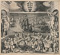
.jpg/120px-Licht_der_Zeevaert%2C_Frontispiz_(cropped).jpg) Licht der Zeevaert, Frontispiz (cropped).jpg 3,225 × 2,939; 2.49 MB
Licht der Zeevaert, Frontispiz (cropped).jpg 3,225 × 2,939; 2.49 MB
-
 Licht der Zeevaert, Frontispiz.jpg 3,394 × 3,118; 2.69 MB
-
.png/120px-Luneta%2C_Instituto_Histórico_e_Geográfico_de_Vila_Velha_(0026_).png) Luneta, Instituto Histórico e Geográfico de Vila Velha (0026 ).png 5,184 × 3,456; 16.9 MB
Luneta, Instituto Histórico e Geográfico de Vila Velha (0026 ).png 5,184 × 3,456; 16.9 MB
-
.png/120px-Luneta%2C_Instituto_Histórico_e_Geográfico_de_Vila_Velha_(0026_A_1).png) Luneta, Instituto Histórico e Geográfico de Vila Velha (0026 A 1).png 4,966 × 3,311; 14.33 MB
Luneta, Instituto Histórico e Geográfico de Vila Velha (0026 A 1).png 4,966 × 3,311; 14.33 MB
-
.png/120px-Luneta%2C_Instituto_Histórico_e_Geográfico_de_Vila_Velha_(0026_A).png) Luneta, Instituto Histórico e Geográfico de Vila Velha (0026 A).png 5,084 × 3,389; 18.15 MB
Luneta, Instituto Histórico e Geográfico de Vila Velha (0026 A).png 5,084 × 3,389; 18.15 MB
-
.png/120px-Luneta%2C_Instituto_Histórico_e_Geográfico_de_Vila_Velha_(0026_B).png) Luneta, Instituto Histórico e Geográfico de Vila Velha (0026 B).png 5,184 × 3,456; 18.5 MB
Luneta, Instituto Histórico e Geográfico de Vila Velha (0026 B).png 5,184 × 3,456; 18.5 MB
-
.png/120px-Luneta%2C_Instituto_Histórico_e_Geográfico_de_Vila_Velha_(0026_C_1).png) Luneta, Instituto Histórico e Geográfico de Vila Velha (0026 C 1).png 4,496 × 2,997; 12.4 MB
Luneta, Instituto Histórico e Geográfico de Vila Velha (0026 C 1).png 4,496 × 2,997; 12.4 MB
-
.png/120px-Luneta%2C_Instituto_Histórico_e_Geográfico_de_Vila_Velha_(0026_C).png) Luneta, Instituto Histórico e Geográfico de Vila Velha (0026 C).png 4,968 × 3,312; 15.8 MB
Luneta, Instituto Histórico e Geográfico de Vila Velha (0026 C).png 4,968 × 3,312; 15.8 MB
-
 Map with border illus. of cherubs using navigational instruments LCCN2005692094.jpg 1,536 × 1,349; 374 KB
-
 Map with border illus. of cherubs using navigational instruments LCCN2005692094.tif 1,536 × 1,349; 1.98 MB
-
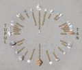 Mau-star-compass.png 782 × 668; 351 KB
-
 Milésima artillera 01.svg 1,000 × 900; 62 KB
-
 Milésima artillera 02.svg 1,000 × 900; 62 KB
-
 Nautical navigation instruments LCCN2011634966.tif 6,140 × 7,649; 89.6 MB
-
 Navigatie.jpg 3,648 × 2,736; 4.21 MB
-
.jpg/90px-Navigation_light%2C_Kiel_(APC_0089).jpg) Navigation light, Kiel (APC 0089).jpg 2,717 × 3,622; 6.51 MB
Navigation light, Kiel (APC 0089).jpg 2,717 × 3,622; 6.51 MB
-
.jpg/80px-Navigational_instrument_(27153870381).jpg) Navigational instrument (27153870381).jpg 3,648 × 5,472; 3.19 MB
Navigational instrument (27153870381).jpg 3,648 × 5,472; 3.19 MB
-
 Navigational rules types.JPG 2,048 × 1,536; 476 KB
-
 Navigationsbesteck 2557.JPG 4,752 × 3,168; 5.52 MB
-
 Navisphere1.jpg 447 × 425; 19 KB
-
 Navisphere2.jpg 417 × 629; 19 KB
-
 Nocturlabe Vienne IMG 8668.jpg 2,304 × 3,456; 3.98 MB
-
_-_transparent.png/80px-Nocturnal_(instrument)_-_transparent.png) Nocturnal (instrument) - transparent.png 600 × 900; 572 KB
Nocturnal (instrument) - transparent.png 600 × 900; 572 KB
-
.jpg/88px-Nocturnal_(instrument).jpg) Nocturnal (instrument).jpg 652 × 892; 50 KB
Nocturnal (instrument).jpg 652 × 892; 50 KB
-
 ProtractorA304.JPG 2,048 × 1,536; 1.35 MB
-
 RepereBourdaloue.jpg 2,205 × 1,731; 542 KB
-
 RK 1701 1184 Kursdreieck.jpg 1,920 × 1,439; 468 KB
-
 RK 1701 1185 Kursdreieck.jpg 1,920 × 1,436; 403 KB
-
 Sappers trek California hills in dead of night 150715-A-TI382-590.jpg 4,898 × 3,265; 6.26 MB
-
 Schweizer Artillerie Promille.svg 1,000 × 900; 163 KB
-
 Sonnenkompass.jpg 397 × 401; 25 KB
-

-
 Unpaved road near Storkow, Germany - panoramio.jpg 550 × 413; 43 KB
-
 UW Navigation tools.jpg 754 × 677; 81 KB
-
.jpg/120px-Velas_Latinoamérica_2022_IMG_8265_(51880258189).jpg) Velas Latinoamérica 2022 IMG 8265 (51880258189).jpg 5,472 × 3,648; 1.22 MB
Velas Latinoamérica 2022 IMG 8265 (51880258189).jpg 5,472 × 3,648; 1.22 MB
-
 Протрактор.jpg 3,223 × 5,231; 6.74 MB
.png)
.png)
.png)


.jpg)

_(44699186944).jpg)
_(45423777361).jpg)
_(30483036427).jpg)
.jpg)


.png)
.png)
.png)
.png)
.png)
.png)
.png)
.png)
.png)
.png)
.png)
.png)
.png)
.png)
.png)
.png)
.png)
.png)
.png)
.png)
.png)
.png)
.png)


.png)

.jpg)
.jpg)
.jpg)
.jpg)
.jpg)
.jpg)


.jpg)

.png)
.png)
.png)
.png)
.png)
.png)


.jpg)
.jpg)


.jpg)


.jpg)

.jpg)
.jpg)
_-_transparent.png)